Mother Nature is preparing to serve up some unappealing conditions for millions of Thanksgiving travelers: sloppy weather, snow, the coldest temperatures since February, and a potentially disruptive storm are all on the way for the holiday weekend.
Here’s a glance at what to expect each day this week.
Thursday
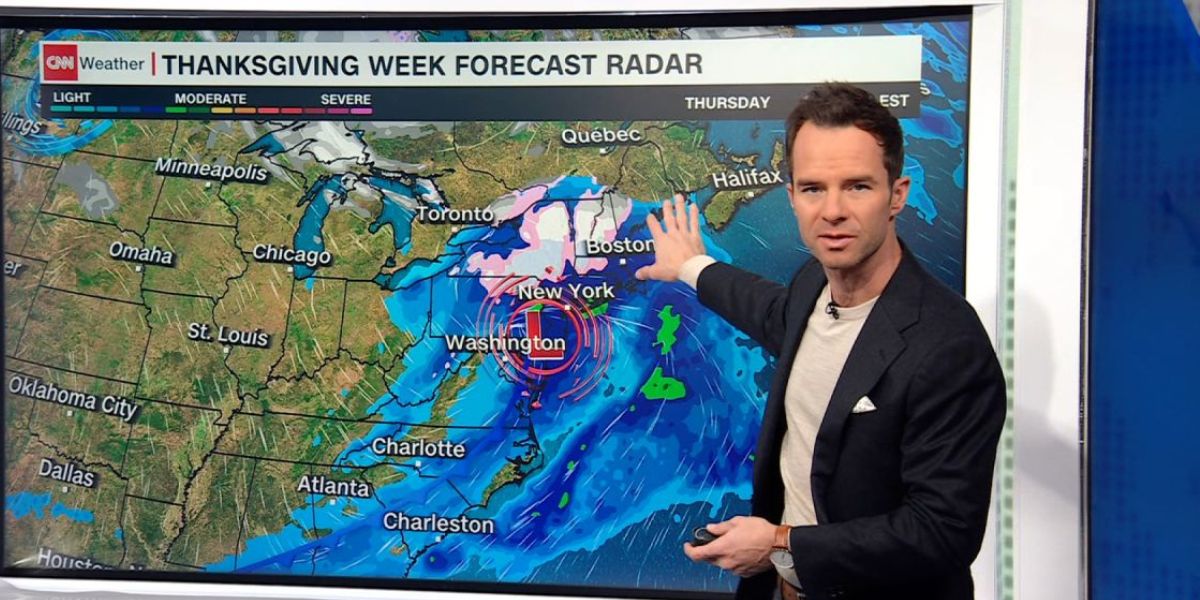
Except for the East Coast, much of the United States will be dry but cold on Thanksgiving Day.
Rain will fall from the Southeast to the Northeast, with light snow covering the interior of the Northeast and northern New England.
“I think Thursday is going to be our messiest day,” CNN Meteorologist Elisa Raffa said Tuesday afternoon. “A lot of us will be looking at some soggy turkeys for Thanksgiving” due to traffic concerns over most of the East Coast.
Rain will not be strong enough to cause flooding, although motorists may experience poor visibility at times. Many locations from the Gulf Coast to New England will receive less than one inch of rain.
Dreary weather with low clouds may pose problems for airports along the Eastern Seaboard.

Wet, sloppy snow will fall at the Northeast’s highest peaks on Thursday. A few inches might accumulate by late Thursday night in northern New York and New England.
Some locations will see extremely chilly temperatures.
“The first significant Arctic outbreak of the season will arrive in the Northern Plains on Thanksgiving,” the Weather Prediction Center reported.
Friday and the Weekend
Dry but cold conditions will develop over the United States.
Millions of people will wake up to the coldest temperatures they’ve experienced in over a year. High temperatures will peak in late December or January-like conditions.
The Thanksgiving Day storm will be mostly out of the way by morning, but lake-effect snow will begin in regions downwind of the Great Lakes as Arctic air surges over the record-warm waters.
Feet of snow may accumulate in certain areas over the course of a few days as it continues to fall into next week.
Wind gusts of 20 to 30 mph will make it quite breezy over the Midwest for much of Friday. These gusts might disrupt operations at the region’s busiest airports.
According to the National Weather Service, lake-effect snow is expected to hinder highway travel on Interstate 90 between Cleveland and Buffalo and Interstate 81 north of Syracuse from Friday until Monday.
“Travel could be very difficult to impossible in the hardest-hit areas,” the weather agency warned. “Forecast accumulations will become more clear as the event approaches.”
According to the National Weather Service office in Buffalo, certain main roads may be closed due to poor visibility and significant snow cover.
The Coldest Air Since Last Winter is Entering.
A massive blast of frigid, Arctic air is hanging over a large portion of the US.
“Temperatures are likely to be the coldest since mid-February in the Northern Plains and Midwest, providing an abrupt change from the record, or near-record, warm autumn so far,” the Weather Prediction Center reported.
Chicago will struggle to reach the mid-30s on Thanksgiving Day, a temperature more suited to late December. Parts of North Dakota will barely reach the teens and feel like January.
Millions from coast to coast will be cold by Friday. Early Friday morning, low temperatures will fall below zero in the Dakotas and into the teens and single digits across much of the north-central United States.
High temperatures as far south as the Gulf Coast are forecast to be 10 degrees or more below average, and some sites may not reach the 60s.
Many areas in the central and eastern United States may suffer their coldest temperatures of the season this weekend.
Philadelphia hasn’t seen a high in the 30s since February, but it could come close on Saturday and Sunday. The same might be said for New York City.
According to the Climate Prediction Center, cold air will remain in the East as the calendar turns to December and may continue into the first week of the new month.

